Atlases, Maps & Gazetteers
Henry Blacklock & Co.
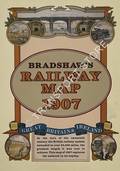
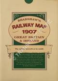
Bradshaw's Railway Map 1907
Reproduction of the map of the Railways of Great Britain and Ireland, first published in the Bradshaw Railway Guide of 1907.

Ian Allan
Sectional Maps of Britain's Railways with Gazetteer
Maps of the BR system with lines colour coded according to Region, or whether independent or closed. This large softback format was first issued for lines at January 1982, with subsequent editions updated to 1985 and 1989.

Ian Allan
British Rail Main Line Gradient Profiles
Later editions subtitled "The Age of Steam".

Ian Allan
British Railway Maps of Yesteryear
Finely produced reproduction of historic maps from timetables and offical publications. Companion volume to "British Railway Postcards of Yesteryear".
Ian Allan
British Rail Atlas / Sectional Maps of British Railways
British Rail Regions Identified in Colour
The first of the Ian Allan BR sectional map volumes with each line colour coded according to BR Regions. This edition, an uncommon spiral bound work, covered the situation at 1966. Subsequent updates were issued from 1982 onwards (see separate listing).

Ian Allan Publishing
British Rail Atlas and Gazetteer - Regions Identified in Colour
Map of the BR lines at time of publication in 1965, similar and based on the 'pre-grouping' atlas by Conolly (search using 'Conolly' as author). Lines coloured to show the BR region responsible, including the then North Eastern Region.