
Atlases, Maps & Gazetteers

London Midland & Scottish Railway
Map of LMS System & Principal Train Services
1932
LMS System map with timetable of train services at the rear (from September 12th 1932 until further notice).
McCARTHY, Colin & David
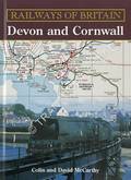
Railways of Britain - Devon and Cornwall
History, photographs and atlas of each railway which operated in Devon and Cornwall. Railway companies, sheds and works are briefly described and photographed. Part of a 'Railways of Britain' series.
![The Railway & Commercial Gazetteer of England, Scotland and Wales [1963] by McCorquodale & Co.](/images/content/books/thumbnail/30432/Copy of P8080485.JPG)
McCorquodale & Co.
The Railway & Commercial Gazetteer of England, Scotland and Wales [1963]
Twenty-first edition, being second revision after nationalisation. Directory of locations across the country showing their nearest railway station, their distance from the station and London, the railway line and the railway companies operating to London.
![The Railway & Commercial Gazetteer of England, Scotland and Wales [1938] by McCorquodale & Co.](/images/content/books/thumbnail/14729/Copy of 062-IMG_6823.JPG)
McCorquodale & Co.
The Railway & Commercial Gazetteer of England, Scotland and Wales [1938]
Comprehensive directory of locations across the country showing their nearest railway station, their distance from the station and London, the railway line and the railway companies operating to London. First produced in the mid-nineteenth century.

MITCHELL, Vic
Route Map, London & South Western Railway: Main Lines - Waterloo to Exeter, Weymouth & Portsmouth
OS map reproductions tracing the LSWR main lines with accompanying notes. This small softback was the first Middleton Press publication, produced in 1978.
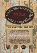
Old House Books & KICHENSIDE, Geoffrey
Railway Maps of Great Britain 1924 - The Big Four Box Set
Maps of the 1924 principle express routes of each of the main line 'Big Four' companies describing the route and its operation. This listing is for the box set of four.
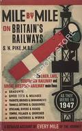
PIKE, S.N.
Mile by Mile on Britain's Railways - The LNER, LMS, GWR and Southern Railway as they were in 1947
Combined re-printing of the lineside guides produced by the author in the 1940's covering the LMS, LNER and SR main lines. A GWR guide was not produced by the author but has been prepared for this volume in the same style.
![Travelling Charts - London and Brighton [1846] by Railway Chronicle](/images/content/books/thumbnail/44350/IMG_8705.jpg)