

Great Britain
![Bartholomew's Railway Map of the British Isles [1944] by John Bartholomew & Son Ltd.](/images/content/books/thumbnail/32747/IMG_3704.jpg)
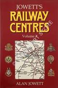
JOWETT, Alan
Jowett's Railway Centres
Alan Jowett's fine colour hand-written maps of twenty railway centres across the country. A chronology is supported by maps from the nineteenth century to 1990 showing the development of each area. A second volume has not been produced to-date.
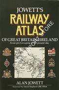
JOWETT, Alan
Jowett's Railway Atlas of Great Britain & Ireland from pre-grouping to the present day
The splendid hand drawn maps charting the railways by area, referencing locations on each line including stations, tunnels, junctions and sidings. Railway company ownership is shown through colour coding the lines. An artwork and essential reference.
Karl Baedeker
Baedeker's Great Britain 1890
The travel companion detailing places of interest to the Victorian traveller. Includes a large foldout England and Wales railway map, principal city maps, and numerous suggested excursions, primarily by train.
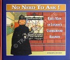
LEBOFF, David & DEMUTH, Tim
No Need to Ask! - Early Maps of London's Underground Railways
McCARTHY, Colin & David
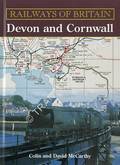
Railways of Britain - Devon and Cornwall
History, photographs and atlas of each railway which operated in Devon and Cornwall. Railway companies, sheds and works are briefly described and photographed. Part of a 'Railways of Britain' series.
![The Railway & Commercial Gazetteer of England, Scotland and Wales [1938] by McCorquodale & Co.](/images/content/books/thumbnail/14729/Copy of 062-IMG_6823.JPG)
McCorquodale & Co.
The Railway & Commercial Gazetteer of England, Scotland and Wales [1938]
Comprehensive directory of locations across the country showing their nearest railway station, their distance from the station and London, the railway line and the railway companies operating to London. First produced in the mid-nineteenth century.
![The Railway & Commercial Gazetteer of England, Scotland and Wales [1963] by McCorquodale & Co.](/images/content/books/thumbnail/30432/Copy of P8080485.JPG)
McCorquodale & Co.
The Railway & Commercial Gazetteer of England, Scotland and Wales [1963]
Twenty-first edition, being second revision after nationalisation. Directory of locations across the country showing their nearest railway station, their distance from the station and London, the railway line and the railway companies operating to London.